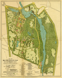
Description
Digitized by Wildlife Conservation Society Archives Language, Map in Scale 1:3,6000, Torn along folds, Extend: 1 map: color ; 37 x 47 cm, folded to 24 x 14 cm, Reformatted digital.
Type of Resource
Map
Rights
For rights and permissions, please contact the Wildlife Conservation Society Archives, library@wcs.org

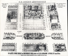
Description
Madison Ave. and East 37th Street. The only remaining buildings are the brownstone on the north side of 37th Street and the Morgan Library's Book Store building (formerly the Lutheran Church in Americ...
Type of Resource
Map
Rights
The images and information provided in this collection may not be reproduced in any form without permission from the Mina Rees Library, The Graduate Center, City University of New York, except for "fair use" as defined by copyright law.
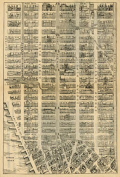
Description
Nineteenth-century map of Midtown Manhattan extending to Greenwich Village. Digital version published by City University of New York. Graduate School and University Center, Mina Rees Library.
Type of Resource
Map
Rights
The images and information provided in this collection may not be reproduced in any form without permission from the Mina Rees Library, The Graduate Center, City University of New York, except for "fair use" as defined by copyright law. Responsibility for making an independent legal assessment of an...